![](/images/other/stat-length.png)
![Randonnée Marche La Vacquerie-et-Saint-Martin-de-Castries - GR7 E17 LaVacquerie-Lodève - Photo](https://media.geolcdn.com/t/1900/400/ext.pjpeg?maxdim=2&url=https%3A%2F%2Fstatic1.geolcdn.com%2Fsiteimages%2Fupload%2Ffiles%2F1553511878bg_sport_marche.png)
GR7 E17 LaVacquerie-Lodève
richard21220
Utilisateur
![Longueur](/images/other/stat-length.png)
Longueur
21 km
![Altitude max](https://static1.geolcdn.com/siteimages/upload/files/1508320355ic_sort_altitude_max_24dp.png)
Altitude max
793 m
![Dénivelé positif](https://static1.geolcdn.com/siteimages/upload/files/1508320355ic_sort_den_pos_24dp.png)
Dénivelé positif
557 m
![Km-Effort](/images/other/stat-length.png)
Km-Effort
30 km
![Altitude min](https://static1.geolcdn.com/siteimages/upload/files/1508320355ic_sort_altitude_min_24dp.png)
Altitude min
155 m
![Dénivelé négatif](https://static1.geolcdn.com/siteimages/upload/files/1508320355ic_sort_den_neg_24dp.png)
Dénivelé négatif
1008 m
![Boucle](https://static1.geolcdn.com/siteimages/upload/files/16400158638029165_repeat_loop_refresh_sync_direction_icon.png)
Boucle
Non
Date de création :
2017-03-10 00:00:00.0
Dernière modification :
2017-03-10 00:00:00.0
![Marche](https://static1.geolcdn.com/sitytour/trail-icons/101.png)
5h54
Difficulté : Facile
![Scannez ce code QR pour ouvrir la randonnée dans l'application SityTrail](https://capi.geolives.com/qq0zvz2zws4bq2lad0pu/sitytour/trails/680933/qr.png?size=200)
Application GPS de randonnée GRATUITE
À propos
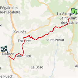
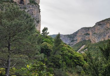
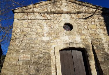
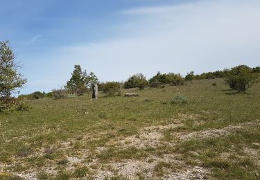
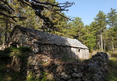
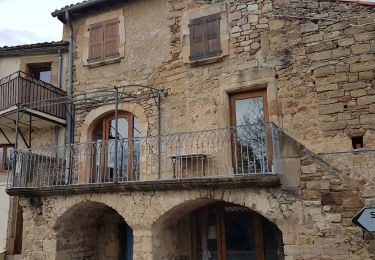
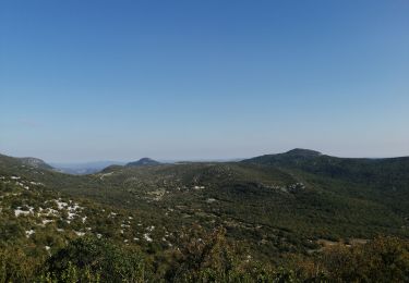
Randonnée Marche de 21 km à découvrir à Occitanie, Hérault, La Vacquerie-et-Saint-Martin-de-Castries. Cette randonnée est proposée par richard21220.
Description
Gîte d'Etape La Mégisserie : Quai Mégisserie 34700 LODEVE Tél 04 99 91 43 30
Hôtels à 34700 LODEVE Tél OT 04 67 88 86 44
Localisation
Pays :
France
Région :
Occitanie
Département/Province :
Hérault
Commune :
La Vacquerie-et-Saint-Martin-de-Castries
Localité :
Unknown
Départ:(Dec)
Départ:(UTM)
536997 ; 4848562 (31T) N.
Commentaires
Randonnées à proximité
![Randonnée Marche Saint-Pierre-de-la-Fage - Parlatges - La Vacquerie-et-St-Martin-de-Castries - Photo](https://media.geolcdn.com/t/375/260/076ea1bb-8acb-4fc6-bfb0-1a2a8946e2fc.jpg&format=jpg&maxdim=2)
![Marche Marche](https://static1.geolcdn.com/sitytour/trail-icons/101.png)
Parlatges - La Vacquerie-et-St-Martin-de-Castries
Marche
Moyen
(1)
Saint-Pierre-de-la-Fage,
Occitanie,
Hérault,
France
![](/images/other/stat-length.png)
14 km | 20 km-effort
3h 43min
![](https://static1.geolcdn.com/siteimages/upload/files/16400158638029165_repeat_loop_refresh_sync_direction_icon.png)
Oui
![Randonnée Marche nordique Saint-Pierre-de-la-Fage - St-Pierre de la Fage - Pas de Cabane - Roqueboude - Bergerie de Courcol - Photo](https://media.geolcdn.com/t/375/260/f3de2af3-46a7-4008-bd2a-646a63c35c72.jpg&format=jpg&maxdim=2)
![Marche nordique Marche nordique](https://static1.geolcdn.com/sitytour/trail-icons/102.png)
St-Pierre de la Fage - Pas de Cabane - Roqueboude - Bergerie de Courcol
Marche nordique
Moyen
Saint-Pierre-de-la-Fage,
Occitanie,
Hérault,
France
![](/images/other/stat-length.png)
15,8 km | 21 km-effort
2h 50min
![](https://static1.geolcdn.com/siteimages/upload/files/16400158638029165_repeat_loop_refresh_sync_direction_icon.png)
Oui
![Randonnée Marche nordique Saint-Pierre-de-la-Fage - St-Pierre de la Fage - Pas de Cabane - Roqueboude - Photo](https://media.geolcdn.com/t/375/260/b0257bf0-1019-48a4-89d5-956e560fc262.jpg&format=jpg&maxdim=2)
![Marche nordique Marche nordique](https://static1.geolcdn.com/sitytour/trail-icons/102.png)
St-Pierre de la Fage - Pas de Cabane - Roqueboude
Marche nordique
Moyen
(1)
Saint-Pierre-de-la-Fage,
Occitanie,
Hérault,
France
![](/images/other/stat-length.png)
10,6 km | 14,9 km-effort
2h 20min
![](https://static1.geolcdn.com/siteimages/upload/files/16400158638029165_repeat_loop_refresh_sync_direction_icon.png)
Oui
![Randonnée Marche La Vacquerie-et-Saint-Martin-de-Castries - La Vacquerie St Guilhem - Photo](https://media.geolcdn.com/t/375/260/6776b6fa-32bb-4389-aa74-60e92a5ab663.jpg&format=jpg&maxdim=2)
![Marche Marche](https://static1.geolcdn.com/sitytour/trail-icons/101.png)
La Vacquerie St Guilhem
Marche
Difficile
La Vacquerie-et-Saint-Martin-de-Castries,
Occitanie,
Hérault,
France
![](/images/other/stat-length.png)
22 km | 30 km-effort
10h 0min
![](https://static1.geolcdn.com/siteimages/upload/files/16400158638029165_repeat_loop_refresh_sync_direction_icon.png)
Non
![Marche nordique Marche nordique](https://static1.geolcdn.com/sitytour/trail-icons/102.png)
Parlatges
Marche nordique
Très facile
(1)
Saint-Pierre-de-la-Fage,
Occitanie,
Hérault,
France
![](/images/other/stat-length.png)
5,8 km | 8 km-effort
1h 34min
![](https://static1.geolcdn.com/siteimages/upload/files/16400158638029165_repeat_loop_refresh_sync_direction_icon.png)
Oui
![Marche nordique Marche nordique](https://static1.geolcdn.com/sitytour/trail-icons/102.png)
St Pierre de la Fage La Vacquerie Le Causse
Marche nordique
Très facile
Saint-Pierre-de-la-Fage,
Occitanie,
Hérault,
France
![](/images/other/stat-length.png)
12,5 km | 15 km-effort
3h 7min
![](https://static1.geolcdn.com/siteimages/upload/files/16400158638029165_repeat_loop_refresh_sync_direction_icon.png)
Oui
![Marche nordique Marche nordique](https://static1.geolcdn.com/sitytour/trail-icons/102.png)
St-Pierre-de-la-Fage - Bergerie de Courcol
Marche nordique
Très facile
Saint-Pierre-de-la-Fage,
Occitanie,
Hérault,
France
![](/images/other/stat-length.png)
12,8 km | 16,1 km-effort
2h 0min
![](https://static1.geolcdn.com/siteimages/upload/files/16400158638029165_repeat_loop_refresh_sync_direction_icon.png)
Oui
![Randonnée Marche Saint-Privat - Les Salces - Carlan - Photo](https://media.geolcdn.com/t/375/260/44e4f369-3e49-43f7-a62d-c17bb6af5e68.jpg&format=jpg&maxdim=2)
![Marche Marche](https://static1.geolcdn.com/sitytour/trail-icons/101.png)
Les Salces - Carlan
Marche
Moyen
(1)
Saint-Privat,
Occitanie,
Hérault,
France
![](/images/other/stat-length.png)
6,6 km | 9,1 km-effort
1h 55min
![](https://static1.geolcdn.com/siteimages/upload/files/16400158638029165_repeat_loop_refresh_sync_direction_icon.png)
Oui
![Randonnée Marche Montpeyroux - Mont St Baudile - Photo](https://media.geolcdn.com/t/375/260/d93aa545-f5ab-49f1-9bc2-37f268eb0277.jpg&format=jpg&maxdim=2)
![Marche Marche](https://static1.geolcdn.com/sitytour/trail-icons/101.png)
Mont St Baudile
Marche
Facile
Montpeyroux,
Occitanie,
Hérault,
France
![](/images/other/stat-length.png)
10,6 km | 13,9 km-effort
2h 55min
![](https://static1.geolcdn.com/siteimages/upload/files/16400158638029165_repeat_loop_refresh_sync_direction_icon.png)
Oui